Ecologically detailed information for vegetation in Alaska and adjacent Canada at high resolution
The AKVEG Map is a suite of tabular and geospatial data products that provide detailed ecological information on vegetation in Alaska and adjacent Canada at high spatial resolution. We designed the AKVEG Map with the following features in mind:
- Repeatable and scalable scripted development process to incorporate new field and remotely sensed data with a regular update cycle.
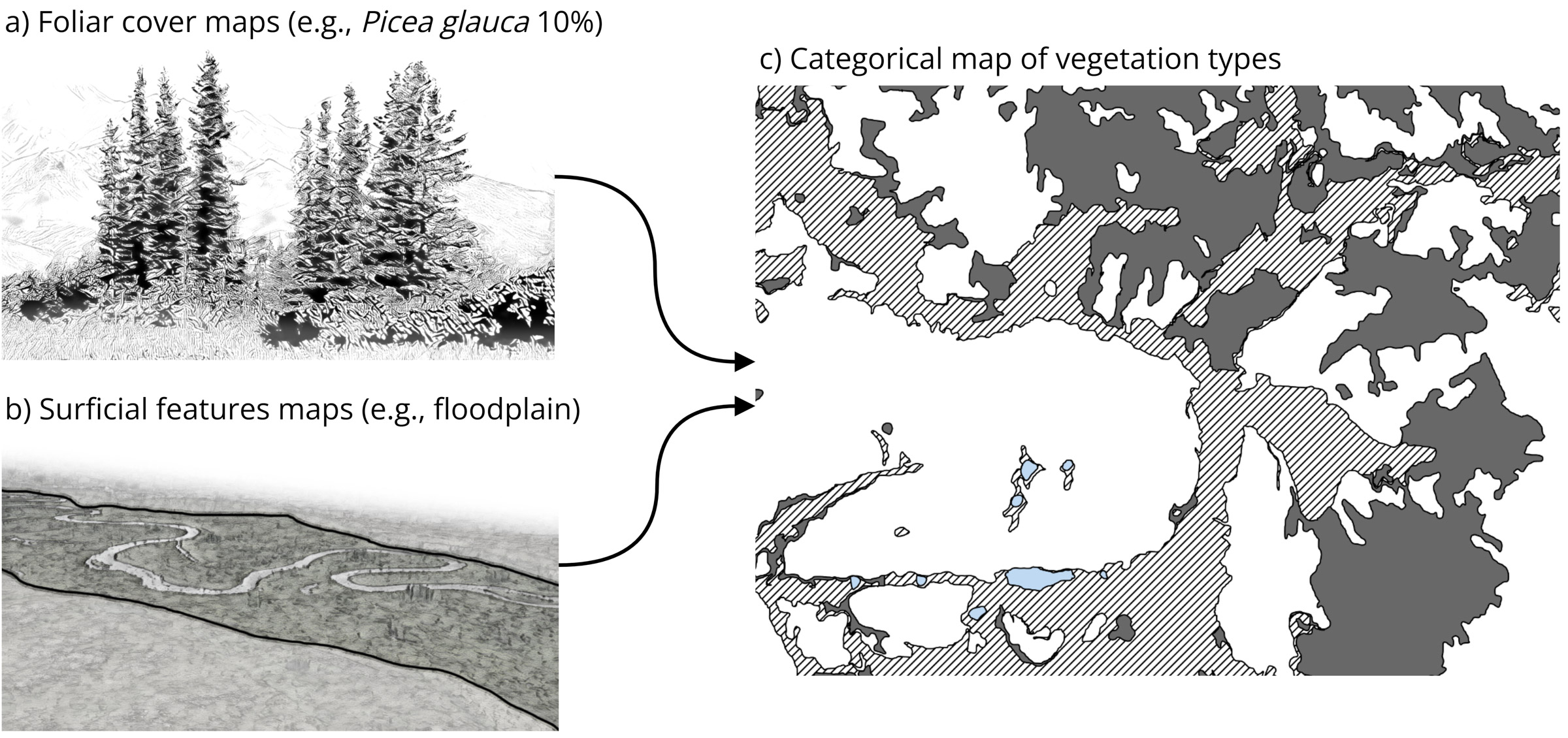
- Breaks ecological complexity into manageable units. Categorical vegetation map is parsed from continuous foliar cover maps surficial features maps (e.g., floodplains).
- Quantify change over time by repeat mapping in the future and through time-series analysis of plant functional type foliar cover maps.
- Remain flexible to variety of end user applications, including continuous maps for quantitative statistical analyses and categorical maps for visual interpretation and study stratification.
The AKVEG Map is developed by a multi-organization collaborative team coordinated through the Alaska Vegetation Working Group (VWG). To become involved in the VWG, please contact co-chairs Timm Nawrocki or Elizabeth Powers for more information.
Framework
The AKVEG Map is a stack of vegetation map products for Alaska and adjacent Canada that consists of continuous foliar cover maps of diagnostic species sets and plant functional types (a), maps of surficial features (b), and a categorical vegetation map derived from the previous two components (c). The power of the AKVEG Map comes from quantifying continuous variation in vegetation community composition and structure while also providing a categorical representation of generalized patterns.
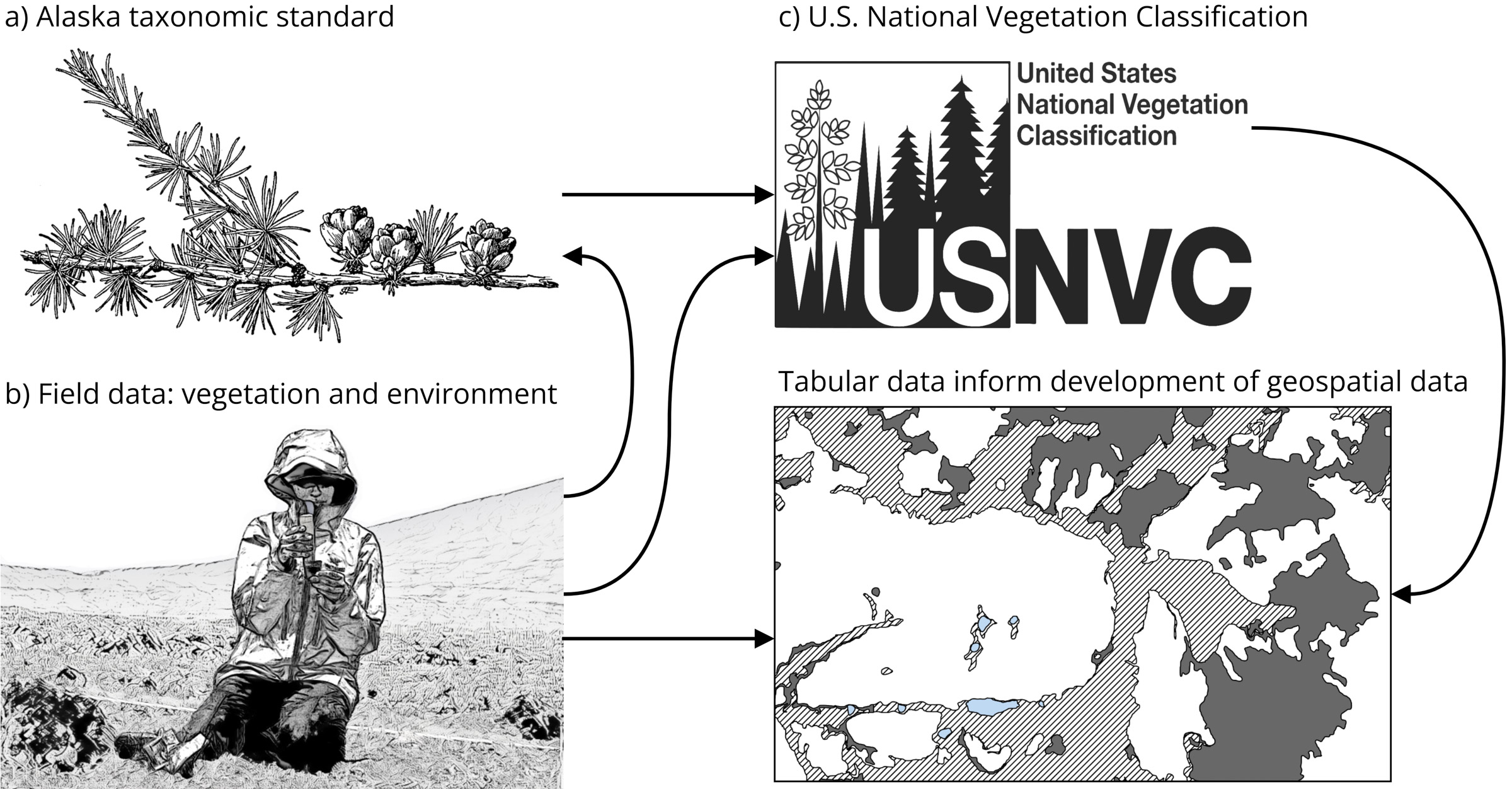
The AKVEG Database is a cloud-hosted database of tabular vegetation data for Alaska and adjacent Canada. The AKVEG Database includes an Alaska Taxonomic Standard (a), which enables reconciliation of various names applied in field studies to produce standardized field observation data (b) from a diverse set of spatially explicit, extensive vegetation studies and ecological monitoring surveys. In turn, the field data and taxonomic standard inform the continued development of the U.S. National Vegetation Classification (USNVC; c). The field data provide training and validation data for the development of the AKVEG Map while the USNVC provides the basis for the mapped types.